NASA’s Mars Pathfinder mission landed on the Red Planet on July 4, 1997. It’s tiny rover, named Sojourner after abolitionist Sojourner Truth, spent 83 days of a planned seven-day mission exploring the Martian terrain, acquiring images, and taking chemical, atmospheric and other measurements. When the Mars Pathfinder spacecraft approached its destination, no NASA mission had successfully reached Mars in more than 20 years. The final data transmission received from Pathfinder was at 10:23 UTC on September 27, 1997.
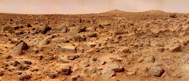
This image shows the Twin Peaks, which are modest-size hills to the southwest of the Mars Pathfinder landing site. They were discovered on the first panoramas taken by the IMP camera on the July 4, and subsequently identified in Viking Orbiter images taken more than 20 years before. The peaks are approximately 100 feet tall (30-35 meters). North Twin is approximately 860 meters (2800 feet) from the lander, and South Twin is about a kilometer away (3300 feet). The scene includes bouldery ridges and swales or “hummocks” of flood debris that range from a few tens of meters away from the lander to the distance of the South Twin Peak.
Mars’ Twin Peaks – Super-Resolution Image From Mars Pathfinder
Read more here –
Source: scitechdaily.com/mars-twin-peaks-super-resolution-image-from-mars-pathfinder/

Leave a Reply